By Russell Street
I have been revisiting Panimálay’s past in the last few weeks. Starting some 8,000 years before the Conclave, when the current calendar began. The Conclave itself is almost ancient history in present-day Yerp, so I am going back quite a way. There is already a detailed history of the world, but I want to look more closely at its earlier periods, make sure they work and develop them further. By creating a more convincing past, I hope to give the present more depth as well.
The reason for doing this now has a great deal to do with the mapping work. In my earlier post I wrote about using terrain and biome information to help generate views of Panimálay. Being able to see places I had previously only pictured in my mind opened up all sorts of possibilities. Working with QGIS has added another dimension to that, opening up ways to develop the history alongside the geography.
QGIS lets me keep various versions of the map, in my case every 500 years, so I can alter rivers, add sediments and reshape coastlines. I know Photoshop or Affinity, or in fact most drawing software with layers and layer groups, would let me do that too. However, QGIS adds the ability to link data directly to the map. A settlement can have information attached to it, and the map can connect to a database containing its history. That gives me a way to bring the geography and the records together.
I can then use the map as a menu to investigate the history of places as well as their present. That is something I want to develop: being able to look at a place, find out what is there today, then go back and explore what was there before. A ruin on the map could lead into the history of the settlement it belonged to, and perhaps further back into the earlier uses of that same ground.
Which brings me back to Era One.
I began by identifying places where people would be likely to congregate and settle into communities. Settlement was particularly important for this work because people constructing things and repeatedly occupying the same ground would leave more readily identifiable archaeological traces and marks in the landscape. Those remains could give me something to find in later periods, linking the early history to the present-day map.
I ended up with four starting locations on the continent of Yerp, in river country, open plains, woodland and highlands. From there I began developing the peoples themselves: how they lived, how they organised their communities and what they constructed that might remain identifiable in later years.
The river people, the Seyu, live in home groups of related households, returning from seasonal journeys to places that continue across generations. Recurring fish runs bring several groups together to catch and preserve food, with their spokesmen agreeing shares according to the mouths each group has to feed. They also maintain a connection with their dead through bones collected after bodies have been exposed on platforms, then placed in pits near home. In their understanding, those dead provide a way to approach the spirits.
The plains people, the Kavren, are large extended family groups travelling out from a home place and repeatedly returning with preserved food. Those who remain at home tend the communal store, and the whole family gathers there for winter. A headman travels with the camp, while elders remain at home and deal with outsiders requesting access to resources. Home also matters to their treatment of the dead: cremated remains are brought back there to rest. If the living later relocate, the dead remain at their old home.
The woodland Orun live in small settlements throughout the year, gathering and trapping, sharing food and preserving supplies for leaner times. Families have their own modest sleeping areas, while most daily activity centres on a communal space. Every adult belongs to the council, with wiser members guiding discussion through experience. They understand spirits to roam the woods and be strongest in particular dwelling places outside the settlement. Their dead are buried in marked graves, where people visit to talk and give them news, while advice from the dead comes through dreams.
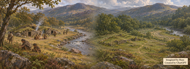
The highland Teshai live in family groups at upland summer homes, coming together in a larger settlement for winter. Both places are home, with substantial dwellings of connected dry-stone chambers and corbelled roofs. Food and meals are family affairs, and a portion is placed on stone shelves for the spirits who dwell there, usually by the children. The dead are cremated and their remains buried beneath the floor of the winter family home, where the Teshai believe they continue to dwell with the living.
There are other people moving through this world too. Some may leave little that would be obvious on a much later map, but their encounters and exchanges can still influence what happens. As I take the history forward, I want to consider those connections alongside the places that leave more substantial remains. At this distance I am looking at the spread of people, what they leave in the landscape and what they set in motion.
That will eventually give me more detail to put on the present-day maps: ruins, earthworks, abandoned places and things to find. Developing their histories means I can consider why they are where they are and what happened to them over the intervening years. A place might be occupied repeatedly, altered by later inhabitants or abandoned as the landscape around it changes.
I could also use those dated maps and records to generate images of the same place through time. A delta, for example, would give me a landscape where channels and coastlines could change, with settlements appearing, growing or vanishing as its history develops. That is a future possibility rather than one of the four settings I have started with, but it shows how all this can link together.
For now, I have reached a useful stopping point with the opening profiles. The next step is to get further into the maps and examine the ground in more detail before deciding exactly where these people belong. That should give me more to work with as I begin moving their histories forward.
So that is why I am spending time thousands of years before the Conclave. I want to deepen the history I already have and see what that adds to the world in its present day. GIS gives me a way to explore the changes, connect the records to places and, eventually, go looking for what remains. There should be rather more to find when I next go wandering around Panimálay.
Russ.
Prepared with AI assistance under Russell Street’s direction.
Header artwork: Imagined by Russ / Created by ChatGPT
Add comment
Comments